Free quiz
Sectional Chart Reading Quiz
19 questions over six real extracts of the Charlotte Sectional (edition effective 2026-10-29). Each one asks you to read something a checkride examiner will point at: the airport data block, the bracketed Class D ceiling, Class B shelf labels, obstacle height pairs, the Maximum Elevation Figure, the part-time tower star. Pick an answer and the verified explanation appears immediately — with the FAA source it was checked against.
Chart imagery is public-domain FAA raster from a single pinned edition. Educational use only — not for navigation. Verify everything against current official publications before you fly.
Concord–Padgett Regional (JQF)
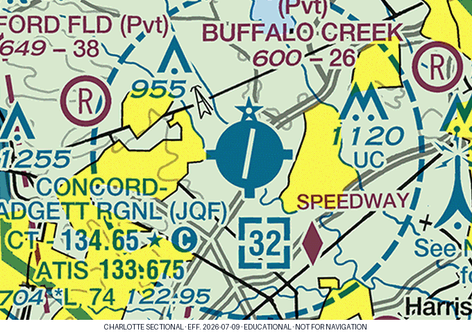
On the Concord–Padgett Regional (JQF) airport data block, you read "CT - 134.65 ★ Ⓒ". What frequency is the CTAF at this airport?
The bottom line of the JQF data block reads "704 *L 74 122.95". What is the field elevation?
In the same JQF data block, the "74" tells you the longest runway is about how long?
The boxed figure [32] just southeast of the JQF airport symbol indicates what?
When the Concord tower is closed, what does the Class D surface area become?
What does the star (★) after "CT - 134.65" mean?
Hickory Regional (HKY)
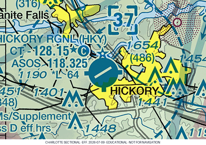
The boxed [37] inside the Hickory Regional Class D means the ceiling is:
Hickory’s Chart Supplement AIRSPACE entry reads "CLASS D svc 1200-0200Z‡; other times CLASS E." Outside tower hours the surface area is therefore:
Northeast of Hickory you read an obstacle marked "1654 (486)". The parenthesized 486 is:
Smith Reynolds, Winston-Salem (INT)
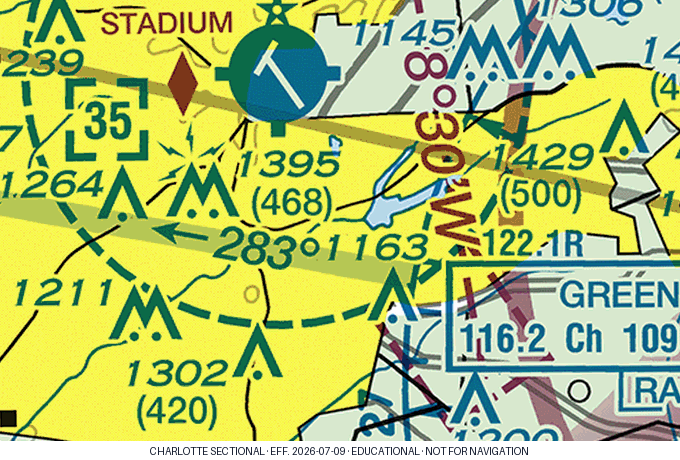
Smith Reynolds (Winston-Salem) carries a boxed [35]. Its Class D extends from the surface to:
Winston-Salem’s AIRSPACE entry reads "CLASS D svc 1145-0230Z‡; other times CLASS G." At 0900Z (before the tower opens), an arriving VFR flight is operating in:
Charlotte — under the Class B
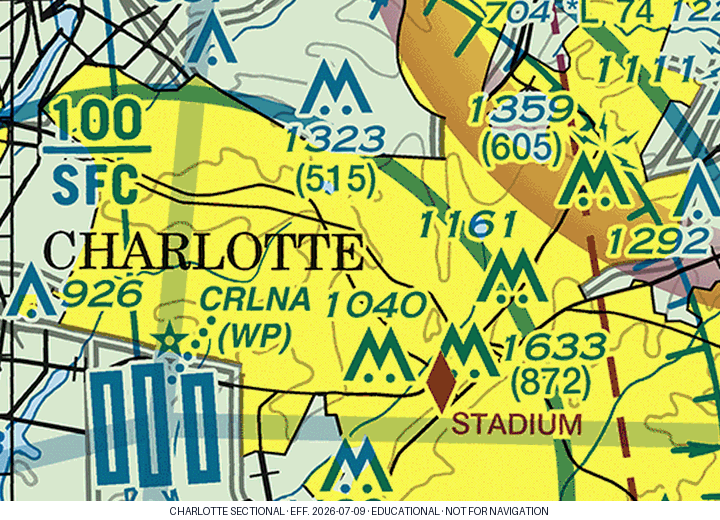
Near Charlotte you read the Class B label "100 over SFC". It means:
Southeast of the city you read "1633 (872)". How tall is that structure above the ground?
Charlotte's Class B is ringed at 30 NM by a solid magenta circle, the Mode C veil — well beyond the edge of this crop. Inside that circle, from the surface to 10,000 ft MSL, your aircraft must have:
Stanly County, Albemarle (VUJ)
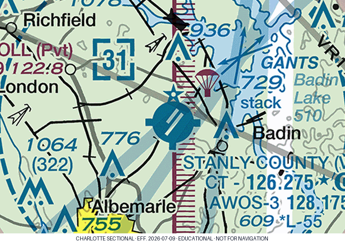
Stanly County (Albemarle) shows a boxed [31]. The Class D there runs from the surface to:
The small parachute canopy symbol just northeast of the Stanly County airport marks:
Reading the quadrangle
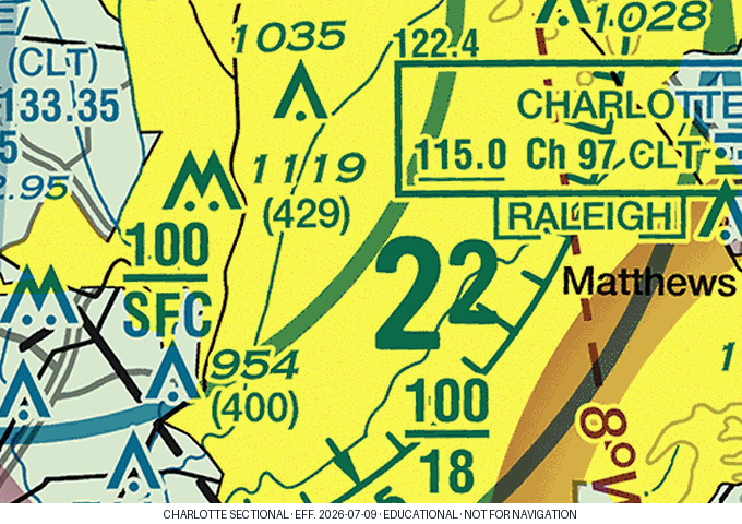
The large "2²" figure printed in this quadrangle (a big 2 with a smaller raised 2) is the Maximum Elevation Figure. What altitude does it represent?
What exactly does a Maximum Elevation Figure include?
Also visible here is the shelf label "100 over 18". Under that shelf, the Class B begins at:
Progress: 0 of 19 answered
Want to interrogate the airspace itself — any point, any altitude, any time? Open the Charlotte Sectional Explorer. The same verified data answers every click.
Free, no signup needed
Next step
- Click any point on the Charlotte sectional (sim)
- Airspace sheet — the rules, quoted (printable)
- VFR cloud clearance — a verified checkride question
- Find your weak areas — the free 24-question Readiness Test, scored by knowledge area.
- Create a free account for the full bank: 3,180 verified questions with the FAA source on every answer, a timed practice exam, and a missed-questions drill.
The Private Pilot Quick-Review Study Guide covers this in the airspace chapter. It is in CFI review and not on sale yet; the guide page has the list for launch notes.